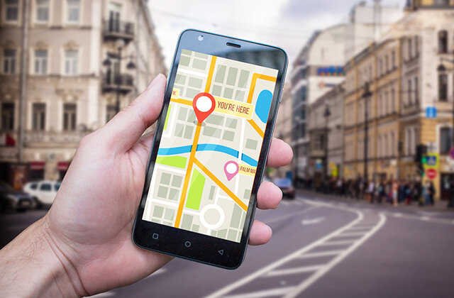
Articles in Tags car supplies

GPS's navigation application

Satellite technology can be traced back to the first generation of satellite navigation systems of maritime navigation to traced back to the 1960s. However, this satellite navigation system was originally designed mainly to serve the polar region and cannot be continuously navigation. The time interval of its positioning changes with latitude.It is above 70 degrees north and south latitude, and the average positioning interval does not exceed 30 minutes, but it takes 90 minutes near the equator. The second and third generation transit satellites launched in the 1980s Navars and Oscars make up10 to 15 minutes.In addition, it is difficult to improve the positioning accuracy (the speed of the Ship is required to accurately know the speed of the Ship), which is mainly used for 2 -dimensional voyage.

The emergence of the GPS system overcomes the limitations of the Transit system, not only high accuracy, continuous navigation, and strong anti -interference capabilities; it can also provide seven -dimensional space -time position speed information.In the initial experimental navigation equipment test, GPS showed that it could replace the TRANSIT and roadbirth radio navigation systems, and played the epoch -making role in navigation navigation.It is difficult to imagine which Ship is not equipped with GPS navigation systems and equipment. navigation applications have become the largest users of GPS navigation applications. This is difficult to compare with users in any other field.

There are many GPS navigation users, and their classification standards are also different. If they are divided according to the type of route, GPS navigation navigation can be divided into five categories: ocean navigation; coastal navigation; port navigation; inland river navigation; lake navigation.

Different stages or regions also have different environmental requirements for navigation safety, but they are to ensure the minimum navigation traffic conflict, and the most effective use of the increasingly crowded routes, ensuring sailing safety, improving transportation benefits, and saving energy.There are roughly the following categories according to the function of the navigation system:

1. Autonomous navigation

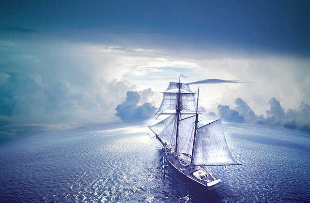
The independent navigation system is suitable for any of the above five routes. It is basically a simple navigation system. Its main feature is to provide users with location, speed, flight direction and time information., No communication system.It is adapted to a Ship that sails on any sea, lakes, and inland, from large ocean cargo ships to private yachts.

2. Port management and guidance of entering the port

This system is mainly used for Ship scheduling management at port/pier and guidance to Hong Kong ships to ensure the safety and order of voyage of ports/pier.The system requires two -way data/phonetic communication to facilitate the leader to guide the Ship; the context/sea map of the port area shows that the mooring ships and the available port routes are avoided to avoid collision.This system requires high accuracy of navigation systems, and uses differential GPS and other enhanced technologies.

3. route traffic management system

This type of system is similar to 2, but it is mainly used for Ship navigation and management on the offshore and inland river routes, and usually requires support of satellite communication systems, such as Inmarsat.

4. Tracking the surveillance system

Such systems are mainly used for maritime patrol boats, anti -smuggling and various yachts, especially private yachts to prevent theft.According to the specific use objects, some systems need to give navigation parameters and two -way data/phonetic communication, such as anti -smuggling boats.Sometimes there is no need to give navigation parameters. For private yacht anti -theft, only one -way data communication is required. Once theft occurs, the navigation system on the yacht continues to send its own position and to the relevant center in order to track it.

5. Emergency rescue system

The system also includes amphibious aircraft, helicopters and land vehicles.It is suitable for all five types of routes to search and rescue all kinds of sea, lakes, and inland risks, dangerous ships and people.This type of system requires two -way data/phonetic communication, which requires fast response time and high positioning accuracy.

6. GPS/Sound combination is used for underwater robots navigation

This type of combination system can be used for underwater pipeline laying and maintenance (required visual system), hydrological measurement, and other sub -operations, such as underwater survey for port/dock, so that the channel obstruction is cleared and the channel is unobstructed.Can be used for ocean fishing, fishing boat operation guidance, etc.

7. Other applications

The navigation techniques used are mainly:

GPS (GNSS);

Sound technology;

INS;

navigation

Radio navigation technology;

Image matching technology;

Other technologies.

The main communication technology adopted is:

FM and TV sub -carrier unidirectional data/speaking communication;

By -way data communication of the benchmark network;

Cluster communication;

Honeycomb communication;

Land mobile digital communication;

Satellite mobile communication;

Drives of traffic.

The first five communication technologies are mainly used for offshore, inland and lake areas.

Disclaimer: The above method stems from the index of the program system or the sharing of netizens. It is for your reference only and does not represent the research perspective of this website. It proves that it is valid. Please pay attention to the authenticity and authority of the source of the content of the content.Apply to delete & gt; & gt; error correction & gt; & gt;

one,Principles of mobile phone navigation

mobile phone navigation is divided into work through GPS modules, navigation software, and GSM communication modules to complete.

1. GPS module completes data collection such as search tracking and positioning speed of GPS satellites.

2. The navigation software map function obtains the location information of the GPS module and constantly refresh the electronic map, so that we constantly move our position on the map.

3. navigation software path guidance calculation function, plan a walking route that reaches the destination according to our needs, and then guide us to walk towards the destination.

4. The GSM communication module completes the communication function of the mobile phone, and can process the collected GPS data according to the mobile phone function and upload the designated website.

2. precautions

mobile phone navigation is that the mobile phone must have general communication functions and navigation functions. There are many mobile phones with navigation functions. The key to buy navigation mobile phones is to pay attention to the following points:

1. Whether the screen is large enough, because the screen is small, it can't be seen clearly, it is inconvenient to use.

2. Whether there is an electronic dog function. The so -called electronic dog function is the reminder function of the monitoring system. It can remind you how many meters in front of you have speed measurement monitoring in front of the vehicle.Do not run through the red light, and so on, which is very practical.

3. The map should be able to update, because the roads will change each year, such as new roads, adjustment of single and double lines, etc., so the map of navigation in the mobile phone must be changed, otherwise it will be inconvenient.

4. Determine whether it is a GPS mobile phone, or an A-GPS mobile phone, the GPS mobile phone is high accuracy, and the A-GPS mobile phone accuracy is slightly lower.

5. Confirm whether the mobile phone navigation will generate other costs during use, such as network traffic fees or GPS software usage fees.

3. Common mobile navigation providers

Figure Bar navigation

The first batch of Beijing Tu Bar Technology (Beijing Tu is Xian Technology Co., Ltd.), which has obtained electronic map licenses. It is the most professional electronic map service provider in China. It was established in 2004. It is a leading industry in the industry that is jointly invested by well -known internationally renowned venture capital institutions.High -tech enterprises.Tu Bar Technology has established a well -known electronic map brand -Tu Bar, and has achieved international professional standards in mobile maps, navigation products and services.The map bar establishes the industry's largest update and timely map information (POI) database and bus line database to fully meet the query and line inquiry of various living information of users.With the significant characteristics of online high -speed browsing, quick query, accurate lines, navigation optimization, and comprehensive data.

Kaelid navigation

Kaelid is a high -tech enterprise based on geographical information data, based on land resources, system platforms, and navigation systems as the three major business pillars.Essence

In the field of GIS applications, Kaelid uses the original space information processing technology to help customers understand the value of geographical information with data visualization and visualization of thinking and make visionary decisions.According to international software engineering standards, Kaelid has developed I-Spatial platform with independent intellectual property rights, X-Bridge, and e-government platform X-Bridge. On the basisProducts; on the basis of geographical information data, Kaelid took the lead in extending business scope from government decision -making support, industry applications to personal GPS navigation applications, and continued to lead the development of the industry.

Gaode

Gaode is the leading domestic digital map content, navigation and location service solutions.Since its start in 2002, various businesses have developed rapidly and have been successfully listed on the Global Seasteak Global Market in the United States on July 1, 2010.

Based on the national and high -quality navigation map database, Gaode accumulates innovation in product, services and business models with rich technical accumulation, and builds a "map cloud service" platform that can cope with various customer types and product forms.Gradually formed a strategic business structure of "four screens and one cloud".The company will closely seize the huge opportunities brought by the mobile Internet for the location service industry. Relying on the leading position in the automotive navigation market, we have strongly entered the public application and service market, and strive to achieve the strategy of establishing a "mobile life service portal".

Tencent Map

On July 9, 2014, Tencent Map officially released the "zero traffic map", covering the two mobile platforms of Android and iOS, becoming the first map product in the industry to achieve real zero traffic and full offline.Use the problem of the map.

China Mobile

"China Mobile's mobile phone navigation" is a mobile navigation client software launched by China Mobile. It provides location -based travel information services, including the current or designated locations of maps, information query, bus or driving route inquiry and guidelines.Practical display, real -time traffic road conditions, positioning family positions, one -click traffic and other practical services.

Disclaimer: The above method stems from the index of the program system or the sharing of netizens. It is for your reference only and does not represent the research perspective of this website. It proves that it is valid. Please pay attention to the authenticity and authority of the source of the content of the content.Apply to delete & gt; & gt; error correction & gt; & gt;

How to mediate signal signal GPS navigator positioning 6 tips

Searching for GPS searches is the most common problem encountered after consumers buying machines. In this article, Xiaobian mainly collects solutions that cannot be searching for stars caused by software problems.The hardware problem is mainly related to receiving chips, antennas, and even cases, which may affect the search star of GPS.Therefore, when buying a machine, don't think that the machine of the metal shell is very good. In fact, it will affect the search star. The most obvious impact is the slow search speed.

One: In the room, basement, subway and other places, it is basically impossible to find stars

Many friends have just taken back the GPS. I opened the GPS at home and found that I could nt find a satellite. The GPS positioner felt strange. When I bought it, I could search for the stars. How could I find it when I got home?For the first time GPS searches, you should find an empty place and wait for a few minutes. If there is no problem with the software, you can basically find the satellite.If you can't find a satellite for a few minutes, you must consider software settings or hardware problems. Generally, the map settings of GPS manufacturers will not have a problem with a problem with the GPS positioner, unless it is a map that consumers add.

Two: I can search the stars before, but I can't search for the star later

In this case, if the settings of all your GPS have not changed, you can try to reset the machine by a reset.In the past, you can search for stars, indicating that there is no problem with the hardware, and the software is normal. This, if Reset cannot solve the problem, you can only find a manufacturer to warranty.

3: Software issues, this is the most common problem encountered by consumers

The software problem is divided into several categories. One is that the download map itself is wrong. Now many forums have map downloads. Some maps can be used by moderators for testing., GPS positioner consumers spend half a day of downloading the map and do not know if they can be used.This is the most headache.Therefore, consumers are best to download the map of the map and test the maps that can be used. This is the most basic premise. If the downloaded map is wrong, other settings will not be able to talk about it.

The second is the problem of Potter rate and port settings, because the hardware settings of each machine are different, which requires different ports and baud rates.There are two segments of the Communist Party of China: one is COM, the other is the baud rate, and the COM port ranges from 1 to 7 (of course there are more, generally from 1 to 7), and there are many types of baud rates.You download the new version of the KLD. After entering the KLD interface, there will be no X -shaped logo on the right of a radar icon on the right side of a small radar icon on the right side of the right.If you appear again, continue to change your COM and I Potter rate.Due to the different machines or GPS map versions, the above two items you choose will be successful.

Copy GPS cannot search signal solution

What should I do if I can't search for satellite signals in GPS?Satellite signals are the basis for GPS to locate and navigation.If you cannot search for a satellite signal, then GPS cannot perform navigation work, which means that your GPS is just a scrap iron.There are 3 cases that cannot search for satellite signals in general GPS:

1. GPS belongs to the cottage in the cottage, and the "use period" is short.

2. The satellite signal is weak, and you can work normally after adjusting the position.

3. Drives from other electrical appliances in the car, it can be used normally after exclusion.

Simple judgment and solution:

To identify the reason why the satellite signal cannot be searched, you can try to locate on an empty Square.Satellite signals are easier to capture on the empty Square, and electrical interference in the car can be excluded.If in this case, it is still impossible to search for satellite signals, then 99%may be that your GPS belongs to a cottage in a cottage, and you should negotiate with the purchase merchant for replacement or even refund.

If you cannot search for signals in the car, when you are close to the window or even the window, you can get a weak signal. We can judge that it is the second case.The ability of GPS Star Search is closely related to the hardware of GPS. Generally, the navigator has built -in antennas. The built -in antenna is relatively small. The receiving original satellite signals are relatively weak, and they cannot even search satellite signals.Owners can choose to install GPS amplifiers to enhance GPS signals.

When using a variety of electrical appliances, such as driving recorders, GPS cannot be used normally.Well, the reason why the GPS signal cannot be searched is most likely the result of the interference of electronic products.Because the signal frequency band is too close, it leads to mutual interference.The owner can choose to use only one of the electrical appliances, or try to wrap the circuit board with Tin foil to eliminate the interference by itself.

GPS navigator positioning 6 tips

I do nt know if there have been such experiences that users have experienced. In the first use, it took a long time in positioning.I did not set the position. At that time, I had a hair in my heart. You Lute was also a big brand. Is there a problem when I bought it?Later, I learned that it was because I was lying on the bed in the bed. How could this be determined?When you come to the Outdoor, you can locate in less than a minute.We may also encounter this or that trouble in positioning, so let's take a look.If the GPS positioning speed is slow (searched time & gt; 5 points), you may wish to follow the following method:

1. When positioning, you may wish to go outdoors because you cannot search for stars indoors.

2. In Outdoor conditions, we must first stay away from high -rise buildings or places with obstruction above (such as under the bridge). In addition, some special places will not be positioned due to the reasons of interference signals such as radiation.If you cannot locate somewhere, move to ten meters away.

3. When searching for stars in the car, we should use the bracket to install it on the front windshield. In addition to the second reason, the front windshield should be inspected whether the metal film is affixed.Because the metal membrane has a screen wall effect on wireless signals, the strength of the satellite signal is too weak.

4. At the same time, pay attention to it. Please do not place two GPS too close when used.GPS distances of different models of the same brand should exceed 10 cm.Please keep long distances with other brands of GPS, because the signal amplification circuit of the GPS will generate radiation to harm the human body. Regular manufacturers like Youlu special will be stricter in design., Will not cause radiation hazards to users, if they are cottage goods, they dare not say it.

5. Before using the new machine for the first time, it must be charged for 4 hours, otherwise there will be a slow search star.

6. If the above situation is excluded, there is still a long time (& gt; 5 minutes) that cannot be found in the stars, then we need to press the "reset key" to restart. Do not wait for a long time.

[car navigation] How to use the car navigation all -in -one button function of the car DVD navigation of the car

The vehicle DVD navigation is powerful and very practical, especially it is very helpful for some new friends and friends, but various buttons on the navigator and various excuses will make people a lot. Let s know the car DVD machines together.The function and use of the keys.Hope to help everyone in the vehicle DVD machine.

Method/Step

1 point ignition key to the ON gear. When the DVD is not turned on, the clock is displayed on the screen

Detailed explanation of vehicle DVD navigation all -in -one button function

2 Press the buttons referred to the fingers in the photo below, and the DVD can be turned on.The following photos are the interface of the radio after turning on.

Detailed explanation of vehicle DVD navigation all -in -one button function

3 Press the upper left corner of the screen at the upper left corner of the screen at the current interface. The main menu interface is displayed in the photo below

Detailed explanation of vehicle DVD navigation all -in -one button function

At 4 o'clock, press the Menu key above the opening to enter the main menu.

Detailed explanation of vehicle DVD navigation all -in -one button function

The function of all the keys of 5DVD is shown in the following photos.Mute key, press the mute of the whole machine, and then press the response sound; switch/volume key, short press is that the captain press is off, and the rotating knob is the size of the volume.Night mode; frequency fine -tuning/audio menu key. When pressing the audio menu, the rotating knob is a fine -tuning of the radio frequency.

Detailed explanation of vehicle DVD navigation all -in -one button function

The 6 -screen display is adjusted to the night mode.

Detailed explanation of vehicle DVD navigation all -in -one button function

The 7 -screen display is closed.

Detailed explanation of vehicle DVD navigation all -in -one button function

Press the icon pointed to the fingers in the photo below to enter the audio menu.

Detailed explanation of vehicle DVD navigation all -in -one button function

9 Press the buttons pointed to the fingers in the following photo can also enter the audio menu. The audio menu see the interface in the photo below.

Detailed explanation of vehicle DVD navigation all -in -one button function

10 Under the audio menu, you can adjust the various audio by rotating the knob under the following, adjust the treble, bass, and subwoofer mode, and adjust the front, back, left, and right channels.

Detailed explanation of vehicle DVD navigation all -in -one button function

The 11SB interface can be buckled with a finger.

Detailed explanation of vehicle DVD navigation all -in -one button function

What are the functions of the car navigation instrument?

1. Location upload: The satellite positioning instrument will upload the parsed position to the background server through the mobile Internet.

2. Real -time positioning: The satellite positioning instrument can collect information about satellite in real time and analyze the information.

3. Session function: After the satellite positioning instrument is positioned, the time accuracy can reach nano seconds.

4. Oil break function: The satellite positioning instrument can remotely break the oil. After the oil is broken, the vehicle will be turned off and will not be started.

5. Speed alarm: You can set up speed warning prompts in the navigator. The alarm will be alarm during the prescribed road section and prescribed operating time, and the bee singer installed in the car makes a noise.

6. Automatic navigation: voice prompts to turn, turn around, etc. The screen shows the information of the map, the location of the car, the speed of the car, the distance between the distance of the destination, and the departure of the driving track also provides a re -planning route function.

7. One -click alarm: The satellite positioner supports the one -click alarm function. In emergency situations, you can send alarm for help.

8. electronic dog function: Through the speed measurement information recorded in the library, the pronunciation reports prompt early warning information in advance.It should be noted that if there is no recorded information point of the ground gallery, the prompt will not be issued, and some car navigator electronic Dogs do not have its own radar chip's unable to warn the flow speed measuring instrument.

precautions for the use of car navigation instrument electronic Dogs

1. It is best to mobilize the car first, and then insert some cigarettes.After the navigation is over, unplug the cigarette lighter, and then insert it after the car is launched next time. This will help protect the machine battery and extend the service life of the battery.

2. After use, follow the order of shutdown: close the page first, then shut down, and finally unplug the plug.Some car owner pictures are convenient, and the plug is pulled directly after use. It never shuts down.

3. Do not put the electronic dog in the sun for a long time and expose the sun. The larger temperature difference not only affects the battery life, but also affects the touch sensitivity of the LCD screen.It is best to put it away after use, do not put it in a prominent position on the car, so as not to provoke a thief.

4. It is best to charge for about 10 hours in the first three times, so that the battery power storage capacity is maximized.

5. Do not let the navigation screen contact sharp objects.

6. The electronic dog function of the navigator is not necessarily accurate and perfect. Some sections do not prompt speed warning, but there are mobile speed measured vehicles for radar speed measuring. Therefore, you cannot just rely on the navigator electronic Dogs to reverse the speed.Of course, to abide by traffic order and control speed in the specified range is the safest.

7. Pay attention to the update of the internal data of the navigator and the upgrade of the electronic dog to avoid the warning prompts cannot be received in a timely manner due to the inadequate data update.

Disclaimer: The above method stems from the index of the program system or the sharing of netizens. It is for your reference only and does not represent the research perspective of this website. It proves that it is valid. Please pay attention to the authenticity and authority of the source of the content of the content.Apply to delete & gt; & gt; error correction & gt; & gt;