How does GPS map and traditional paper maps collect and processes the GPS navigation map
1. The composition of the GPS map
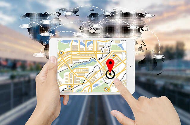
The GPS map is a brand new geographical information carrier produced by the development of computer technology. The GPS map is born out of the map, presented the map in a digital manner, and can only be used in the computer.GPS maps have the functions of displaying, transmission and analysis. GPS maps can provide better presentations than traditional maps, such as enlarged, reduced, roaming, search, and path planning.
2. The difference between GPS map and traditional paper map
The conventional paper map emphasizes the data carrier, symbolization, and display. It is one of the roots of the development of GPS maps, and the GPS map focuses on analysis. Its expression method is much stronger than traditional maps. It has the following characteristics:
A. Integration of sound, graphic and digital multimedia, combine the intuition of graphics, the accuracy of numbers, the guidance of sound, and intimacy, make full use of the user's various sensory.
B. Inquiry retrieval and analysis function can support two -way retrieval from map graphics to attribute data and attribute data to graphics data.
C. Graphic dynamic changes function, from opening window scaling, browsing reading and other basic functions to the end of the animation function, multi -dimensional animation graphics simulation, etc.
D. With a good user interface, the use of users from the map generation process.
E. The multi -level ratio is converted from each other. It can match the screen content of the screen to perfectly match the current proportion, and automatically use the choice or synthesis of the compatibility of the ratio to the scale.
3. GPSHow is navigation electronic map collected and processed?
There are many collection methods for aviation electronic maps. There are mainly. Through remote sensing satellite pictures, analysis of the road network. In addition, based on the purchase and mapping unit from various places, the accuracy of the map is compared.By parsing through unmanned aircraft aerial pictures to obtain map data, and then from the national basic geographical information center activity related information;
The other is to collect on the spot, using artificial and vehicles for field collection and taking pictures to obtain map information.In these collection methods, there are only third types. The map data obtained on the spot is the most accurate and detailed.At present, there is only Ruitan Wanfang's Taoist Map of Ruitan Fang. In addition, many other companies have started to collect on the spot, but it is already later than Ruitanfang in terms of time.4Year.
Disclaimer: The above method stems from the index of the program system or the sharing of netizens. It is for your reference only and does not represent the research perspective of this website. It proves that it is valid. Please pay attention to the authenticity and authority of the source of the content of the content.Apply to delete & gt; & gt; error correction & gt; & gt;